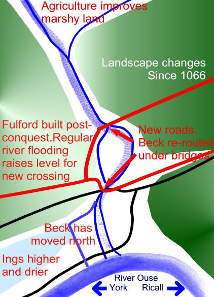
 |
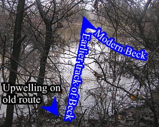
The line of the beck that was revealed by the deep soil cores is evident during a modest flood. The old route and its course to the Ings is the first to flood as water rises. |
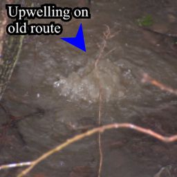 The upwelling is at the spot where the old route reached the Ings (see map at the top of the page). |
This might be an old culvert built when the bridge was built and the beck re-routed. No records of this work can be traced. |
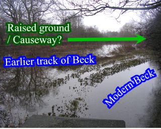 This photo was taken from the Stone bridge, the old course of the beck runs between some raised land and the modern route. |
We have been trying to identify a causeway on this higher ground which was possibly used until about 7th century. |
A full interpretation of the landscape of 1066 will be published during 2007. The flooding pattern help to confirm the model developed from all of the bore-holes.