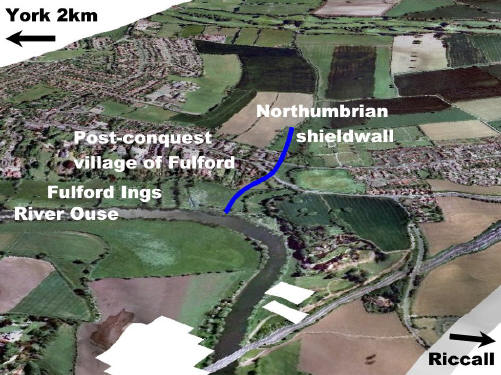
The shield wall drawn up by earl Morcar on 20 September 1066 would have blocked access to York. The area to the top of the map was passable but marshy. The area of near the river was thinly defended as it was very wet but the bank itself was held by Morcar's brother earl Edwin of Mercia.
The modern map illustrates how little the site has been disturbed in the intervening 940 years. The shield wall is line chosen by the developers for their access road to 750 house planned for the fields at the top of the picture.
Based on a map generated Keith Challis