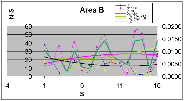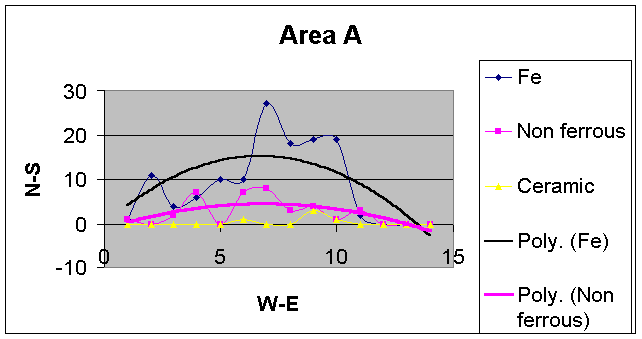
- These are graphic representations of the data from the first 2 area
surveyed.
- The trend lines use a polynomial formula to fit a curve to the data
- The variations in find density reflect many factors including the state of
the ground, the person and equipment performing the survey.
- However, there might be some significance to the peaks. This will only
emerge with further work.
- The terrain has a slope and parts are subject to flooding which might
influence the local density
- This is based on 700+ finds. Photos
- The plan is to plot this background and use it as a reference when other
areas are examined.
- For security reasons, the location is not disclosed.
- 26 January 2003