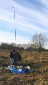
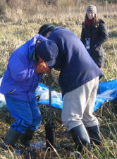
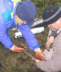
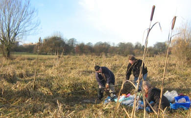
Soil survey is being used extensively in the investigation.
Crossing point
Images
 |
The aim is to:
- Check the depth of the 1066 layer to know if it is worth using metal
detectors. If more than 50cm of silt or soil overlay the 106 layer, it is
unlikely that any finds will be detected.
- To find which landscape was firm enough to support warriors. The
literature refers to marsh land and dikes which the survey work is helping
to reveal. Demonstrating that the Ings were waterlogged in 1066 can rule
out areas as suitable for the battle.
- To extract micro-fossils, charcoal and other items to help date the
layers and better understand the landscape.
- Landscape archaeology
|
| The work has given us a
clear picture of the 1066 land surface of the battle. It reveals a landscape
that fits the literature even better than the present surface. This match
has improved our confidence in the Norse, written sources. |
 |
Photos by Tim Burrows
We have used a power auger to probe those areas where the hand augers
will not penetrate. These have taken cores from the Ings down to 8m.
The cores are stored and available for any scholars who would like to
conduct further research. Images of some of
the cores.